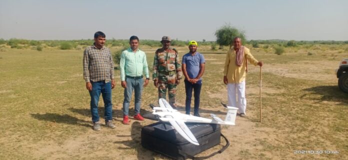
NEW DELHI: For the first time since independence, entire defence land (around 18 lakh acres) has been surveyed by using modern survey technologies like Electronic Total Station (ETS) and Differential Global Positioning System (DGPS) including Drone imagery and Satellite imagery, informed the Ministry of Defence on Sunday.According to the ministry, the entire exercise of survey of about 1.61 lakh acres of defence land inside cantonments and 16.17 lakh acres outside cantonments (total 17.78 lakh acres) survey has been completed.”Modern survey technologies like Electronic Total Station (ETS) and Differential Global Positioning System (DGPS) were used in the survey. To further speed up the process, Drone imagery and Satellite imagery-based surveys were leveraged for reliable, robust and time-bound outcomes,” reads the official release.For the first time, Drone imagery-based survey technology was used for the survey of lakhs of acres of defence land in Rajasthan. The entire area was surveyed with the help of the Surveyor General of India in a matter of weeks, which earlier used to take years.Besides this, Satellite Imagery based survey was done for the first time for many defence land pockets, especially for certain pockets again measuring lakhs acres of defence land.3D Modelling techniques for better visualisation of defence land in the hilly area have also been introduced by utilising Digital Elevation Model (DEM) in association with Bhabha Atomic Research Centre (BARC).During the last 6 months, as a result of the active intervention of the Defence Secretary and use of the latest survey technologies, the survey progressed at a much faster pace, which is evident from the fact that out of 17.78 lakh acres, 8.90 lakh acres was surveyed during the last three months.As a part of the Survey, a project for a real-time change detection system based on the Time series Satellite imagery for detection of encroachments on defence land has also been initiated. A pilot test has been carried out on satellite imageries of defence land pockets procured from the National Remote Sensing Centre, Hyderabad.Geo-referenced and digitised shapefiles are made available to enable quick decision making by officials of DGDE and MoD.Association of Revenue officials in the survey will eventually help in reducing boundary disputes amongst stakeholders and would also help in resolving legal disputes at various levels.
ABOUT US
Sach News® - raising the voice of people of Jammu Kashmir since 1940. We are Publishing House of Daily Sach (Urdu Daily). Sach News, is one of the Oldest News Group of India having its office in Jammu Kashmir, Delhi. Reach us for Latest news on politics, sports, crime, education, real estate, business entertainment and much more. We provide you with the latest breaking news and videos straight from the ground zero.
Contact us: [email protected]
© Sach News Network 2011-2024 | Maintained by Sach Info Tech


